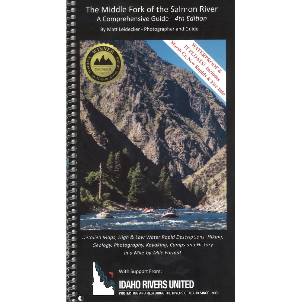
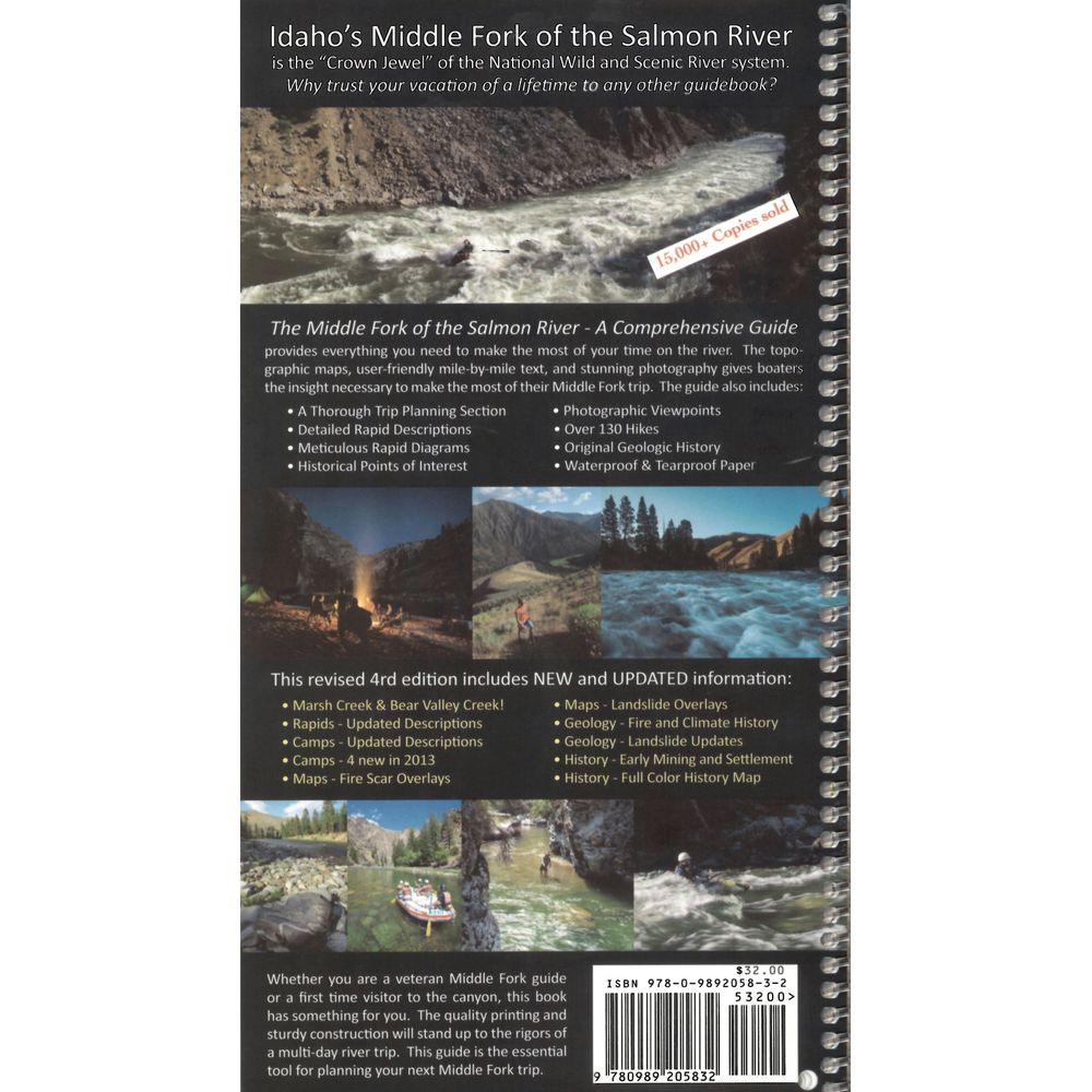
Middle Fork of the Salmon River Guide Book 4th Ed.
Item: 66009.03


This product is no longer available, but we’ve got more options for you:
Product Details
The 4th Edition of Matt Leidecker's Middle Fork of the Salmon River Guide Book delivers mile-by-mile rapid descriptions with detailed maps and photos all printed on waterproof paper. The quality printing and sturdy construction will stand up to the rigors of a multi-day river trip.
Copyright: 2006, revised 2017
Winner of the National Outdoor Book Award
- Spiral bound and printed on durable waterproof, tearproof paper, this detailed 110-page guide floats and has all the information needed for a successful Middle Fork trip.
- The 4th Edition printing covers Marsh and Bear Valley Creeks, updated rapid and camp descriptions, maps with fire scar and landslide overlays, as well as historical information on early mining, settlement, fires and climate.
- The color topo maps are created from the National Geographic TOPO software in 1:15,000 format with added rapid, camp and historical landmarks locations.
- Includes permit information, fishing, camping and other trip planning tips, over 130 side hike options and GPS coordinates for all campsite locations.
- With book in hand, maps read from bottom to top to match the downstream flow of the river.
- Twenty-one pages of geologic history and mile-by-mile lists of creek blowouts and geologic events.
Copyright: 2006, revised 2017
Winner of the National Outdoor Book Award
Specs
| Subject Matter: |
|
|---|---|
| Subject Location: | West |
| Author: | Matt Leidecker |
| Copyright: | 2006, revised 2017 |
| Size: | 6" x 11" |
| Pages: | 110 |
'%3e%3cg id='Final-Copy-2_2_' transform='translate(1275.000000, 200.000000)'%3e%3cpath class='st0' d='M7.4,12.8h6.8l3.1-11.6H7.4C4.2,1.2,1.6,3.8,1.6,7S4.2,12.8,7.4,12.8z'/%3e%3c/g%3e%3c/g%3e%3c/g%3e%3cg id='final---dec.11-2020'%3e%3cg id='_x30_208-our-toggle' transform='translate(-1275.000000, -200.000000)'%3e%3cg id='Final-Copy-2' transform='translate(1275.000000, 200.000000)'%3e%3cpath class='st1' d='M22.6,0H7.4c-3.9,0-7,3.1-7,7s3.1,7,7,7h15.2c3.9,0,7-3.1,7-7S26.4,0,22.6,0z M1.6,7c0-3.2,2.6-5.8,5.8-5.8 h9.9l-3.1,11.6H7.4C4.2,12.8,1.6,10.2,1.6,7z'/%3e%3cpath id='x' class='st2' d='M24.6,4c0.2,0.2,0.2,0.6,0,0.8l0,0L22.5,7l2.2,2.2c0.2,0.2,0.2,0.6,0,0.8c-0.2,0.2-0.6,0.2-0.8,0 l0,0l-2.2-2.2L19.5,10c-0.2,0.2-0.6,0.2-0.8,0c-0.2-0.2-0.2-0.6,0-0.8l0,0L20.8,7l-2.2-2.2c-0.2-0.2-0.2-0.6,0-0.8 c0.2-0.2,0.6-0.2,0.8,0l0,0l2.2,2.2L23.8,4C24,3.8,24.4,3.8,24.6,4z'/%3e%3cpath id='y' class='st3' d='M12.7,4.1c0.2,0.2,0.3,0.6,0.1,0.8l0,0L8.6,9.8C8.5,9.9,8.4,10,8.3,10c-0.2,0.1-0.5,0.1-0.7-0.1l0,0 L5.4,7.7c-0.2-0.2-0.2-0.6,0-0.8c0.2-0.2,0.6-0.2,0.8,0l0,0L8,8.6l3.8-4.5C12,3.9,12.4,3.9,12.7,4.1z'/%3e%3c/g%3e%3c/g%3e%3c/g%3e%3c/g%3e%3c/svg%3e) Your Privacy Choices
Your Privacy Choices NRS Gift Card: Always Fits, Always Wanted


