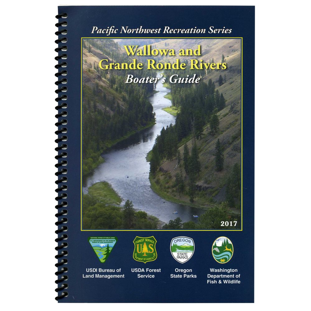
Wallowa & Grande Ronde Rivers Boater’s Guide Book


This product is no longer available, but we’ve got more options for you:
Product Details
Printed on waterproof paper, the Wallowa & Grande Ronde Rivers Boater's Guide Book covers the lower ten miles of the Wallowa River and the lower 81.5 miles of the Grande Ronde River.
- Maps cover the Wallowa and Grande Ronde river corridor between Minam, Oregon and Heller Bar, Washington.
- Spiral bound and printed on durable, waterproof paper for easy, on-water reference.
- Includes information on permits, required equipment, camping regulations and restrictions and river etiquette guidelines.
Specs
| Weight: | 2 oz. |
|---|---|
| Subject Matter: |
|
| Subject Location: | West |
| Author: | Bureau of Land Management |
| Copyright: | 2017 |
| Size: | 6" x 9" |
| Pages: | 26 |
You May Also Like
Reviews
Due to your cookie choices, we cannot show you this content. Adjust your settings?
Questions
Due to your cookie choices, we cannot show you this content. Adjust your settings?
 NRS Gift Card: Always Fits, Always Wanted


