RiverMaps Dolores River of Colorado & Utah Guide Book
Shop All RiverMaps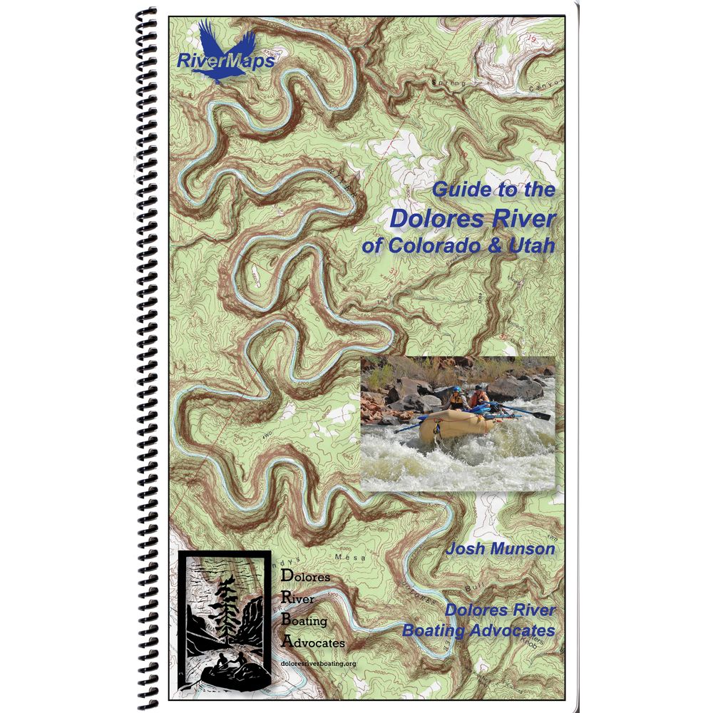
This product is no longer available, but we’ve got more options for you:
Product Details
Draining a rugged and arid region of the Colorado Plataeu, the Dolores River's name derives from the Spanish El Rio de Nuestra Senora de Dolores, which tranlates to River of Our Lady of Sorrows. The RiverMaps Dolores River of Colorado & Utah offers river runners mile-by-mile descriptions for this mellow desert run.
Author: Josh Munson
Copyright: 2020
Size: 9"W x 14"H waterproof paper
Pages: 72
Map Pages: USGS 7.5" color topo reproductions
Scale: 2,000 feet per inch (1:24,000)
- This book covers 174 miles of the Dolores River from Bradfield Recreation Area in Colorado to Dewey Bridge in Utah.
- High quality waterproof, tear-resistant paper handles the splash and abuse of negotiating rivers.
- Spiral bound format with full color topo maps on right side and complete text descriptions on the facing page.
- The topo maps are the same scale as the original USGS maps. The contour lines and accurate shape of the river really help you keep track of where you are.
- Excellent mile by mile information on rapids, campgrounds, geological features, historical sites and reference points.
- Includes info pages on side hikes, frequently asked questions about boating the river, area geology, archaeology, resources protection and plants found along the river, as well as emergency contact information.
- Archival information retells the history of the first ever run from Dolores, CO to Moab, UT in 1948.
Author: Josh Munson
Copyright: 2020
Size: 9"W x 14"H waterproof paper
Pages: 72
Map Pages: USGS 7.5" color topo reproductions
Scale: 2,000 feet per inch (1:24,000)
Specs
| Subject Matter: |
|
|---|---|
| Subject Location: | Southwest |
| Author: | Josh Munson |
| Copyright: | 2020 |
| Size: | 9" x 14" |
| Pages: | 72 |
| Features: |
|
You May Also Like
Reviews
Due to your cookie choices, we cannot show you this content. Adjust your settings?
Questions
Due to your cookie choices, we cannot show you this content. Adjust your settings?
 NRS Gift Card: Always Fits, Always Wanted


