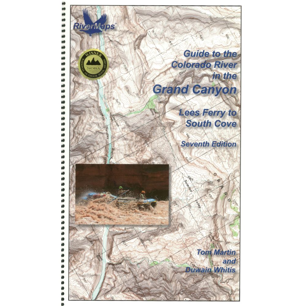
RiverMaps Colorado River in the Grand Canyon 7th Ed. Guide Book


This product is no longer available, but we’ve got more options for you:
Product Details
The RiverMaps Guide to the Colorado River in the Grand Canyon is a must-have guidebook for your trip down the Grand. The USGS topo maps are durable, waterproof and offer excellent descriptions of the river features.
Copyright: 2018
Size: 9" x 14"
Pages: 119
- This 7th Edition book covers the entire river, from the Lees Ferry launch site to the South Cove take out on Lake Mead with up-to-date data on camps and river features.
- Spiral-bound format with full-color topographical maps on the right side and complete text descriptions on the facing page.
- With book in hand, maps read from bottom to top to match the downstream flow of the river.
- High-quality waterproof paper prevents ink from smearing and is tear resistant to keep your guide intact throughout your trip.
- Relief shading of the topo map offers a much clearer perspective of the terrain.
- Excellent mile-by-mile information on rapids, campgrounds, geological features, historical sites and reference points.
- The topo maps are the same scale as the original USGS maps. The contour lines and accurate river shape enhances your ability to keep track of where you are.
Copyright: 2018
Size: 9" x 14"
Pages: 119
Specs
| Subject Matter: |
|
|---|---|
| Subject Location: | Southwest |
| Author: | Tom Martin & Duwain Whitis |
| Copyright: | 2018, 7th Edition |
| Size: | 9" x 14" |
| Pages: | 119 |
| Features: |
|
You May Also Like


Reviews
Due to your cookie choices, we cannot show you this content. Adjust your settings?
Questions
Due to your cookie choices, we cannot show you this content. Adjust your settings?
 NRS Gift Card: Always Fits, Always Wanted


