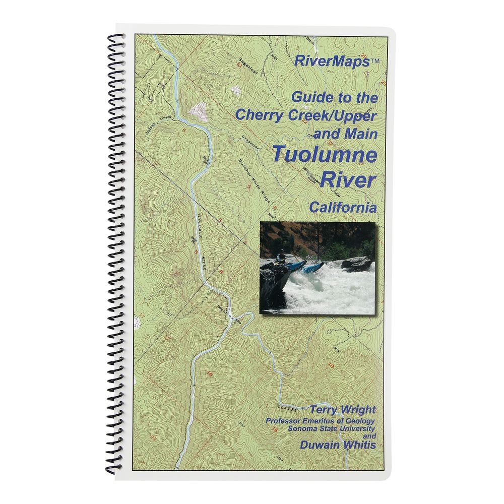
RiverMaps Cherry Creek & Tuolomne River Guide Book
Shop All RiverMapsProduct Gallery
Product Gallery Thumbnails


Price: $21.95
Running the “T” is a premier North American whitewater experience, but the fun is proportional to the complexity of logistics. This RiverMaps™ Guide gives you the info you need to get it right.
Product Details
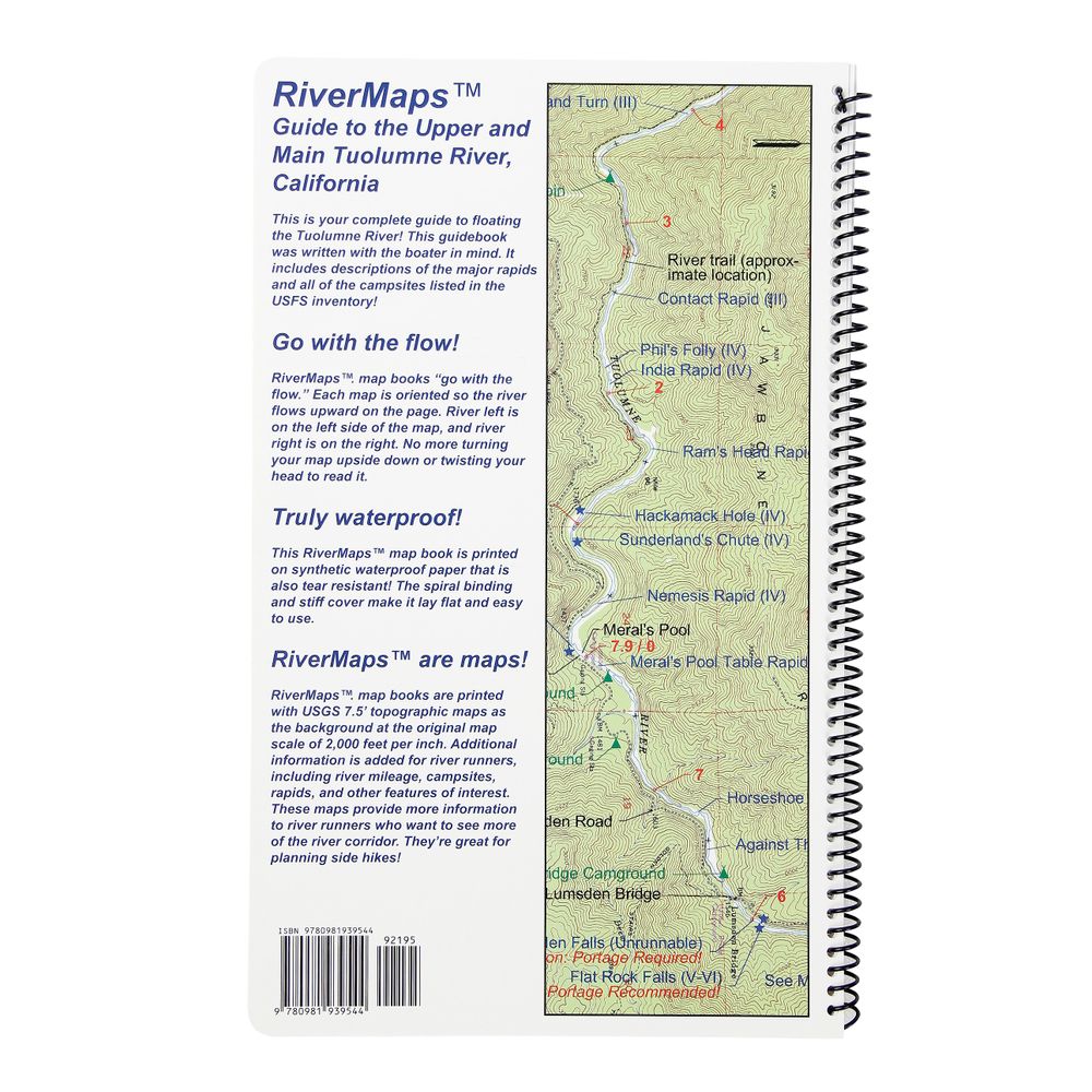
- Includes info on getting to the river, preparing equipment, shuttles, navigating rapids and year-to-year variables that could affect your trip.
- Covers the Cherry Creek, Upper and Main sections of the Tuolumne River.
- A favorite with river runners everywhere, RiverMaps guidebooks are a boating essential.
- Spiral bound format with full color topo maps on right side and complete text descriptions on the facing page.
- Excellent mile by mile information on rapids, campgrounds, geological features, historical sites and reference points.
- The topo maps are the same scale as the original USGS maps. The contour lines and accurate shape of the river really help you keep track of where you are.
- Features detailed descriptions of the Tuolumne’s rich geological history.
- The high quality waterproof paper really stands up to the soaking it’s going to get!
Specs
Subject Matter:
- Guidebooks
Subject Location:
West
Author:
Tom Martin & Duwain Whitis
Copyright:
2011
Size:
9" x 14"
Pages:
28
Water Resistant:
Yes
Features:
- Waterproof
- USGS 7.5" color topo map reproductions
- Scale: 2,000 feet per inch (1:24,000)
You May Also Like

Reviews
Due to your cookie choices, we cannot show you this content. Adjust your settings?
Questions
Due to your cookie choices, we cannot show you this content. Adjust your settings?
 NRS Gift Card: Always Fits, Always Wanted


