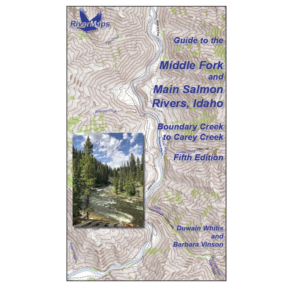
RiverMaps Middle Fork & Main Salmon River 5th Edition Guide Book
Shop All RiverMapsProduct Gallery
Price: $37.95
A must-have guidebook for your trip down the Salmon, the RiverMaps Guide to the Middle Fork and Main Salmon Rivers features USGS maps, historical insights and excellent descriptions of river features. Plus, it’s waterproof and durable to boot.
Product Details
- This book covers the entire permitted portions of Idaho’s Salmon River, from the Boundary Creek launch site on the Middle Fork to the Carey Creek take out on the Main Salmon.
- Spiral bound format with full color topo maps on right side and complete text descriptions on the facing page.
- Lie-flat design for ease of use when rafting.
- Color photos highlight some of the river’s more famous attractions and features.
- Excellent mile by mile information on rapids, campgrounds, geological features, historical sites and reference points.
- The topo maps are the same scale as the original USGS maps.
- Relief shading of the topo map offers a much clearer perspective of the terrain.
- High-quality waterproof paper prevents ink from smearing and is tear resistant to keep your guide intact throughout your trip.
- The book lists numerous side hikes and interesting features away from the river, info pages on frequently asked questions about boating the river, area geology, archaeology, resources protection, flora and fauna.
Specs
Subject Matter:
- Guidebooks
Subject Location:
West
Author:
Duwain Whitis & Barbara Vinson
Copyright:
2025
Size:
9" x 14"
Water Resistant:
Yes
You May Also Like

Reviews
Due to your cookie choices, we cannot show you this content. Adjust your settings?
Questions
Due to your cookie choices, we cannot show you this content. Adjust your settings?
 NRS Gift Card: Always Fits, Always Wanted


