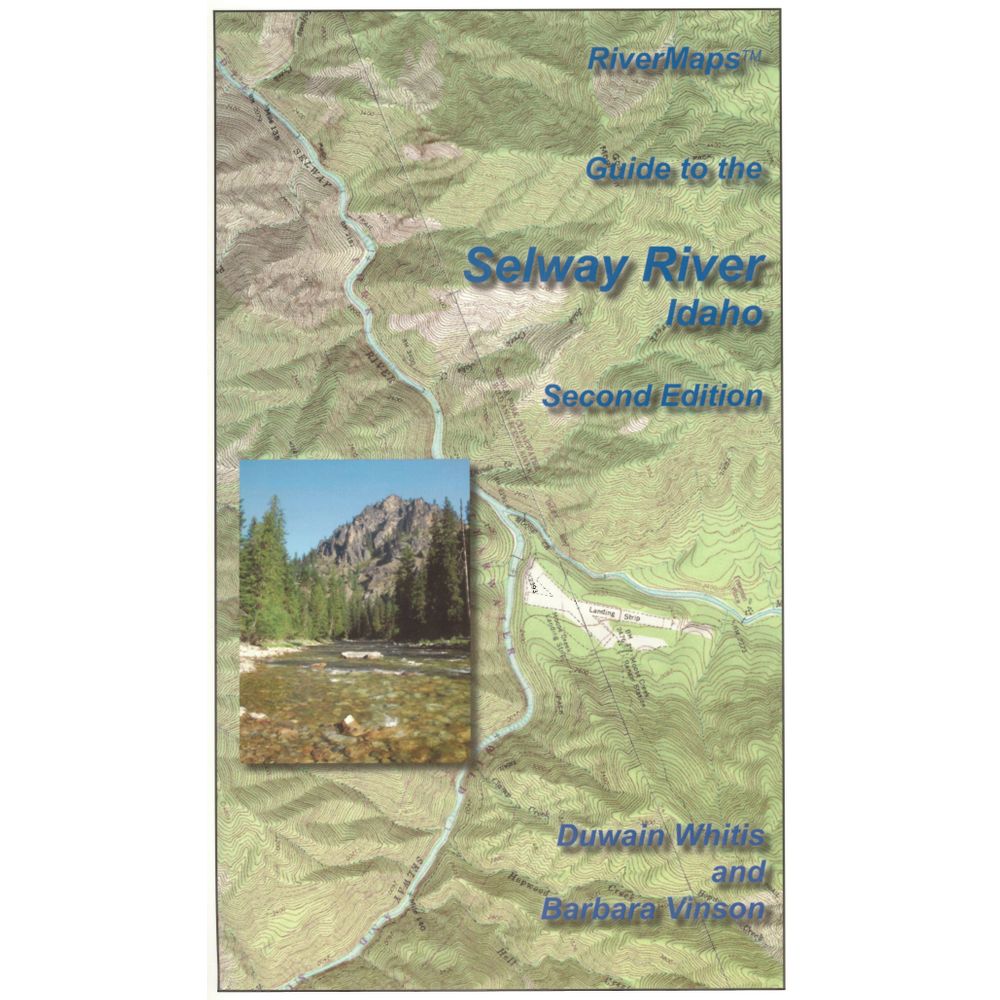
RiverMaps Selway River Guide Book
Shop All RiverMapsProduct Gallery
Product Gallery Thumbnails


Price: $26.95
RiverMaps Guide to the Selway River is just the ticket for your trip down this scenic wilderness river. Includes history, points of interest, and of course maps, with tips for running safely.
Product Details
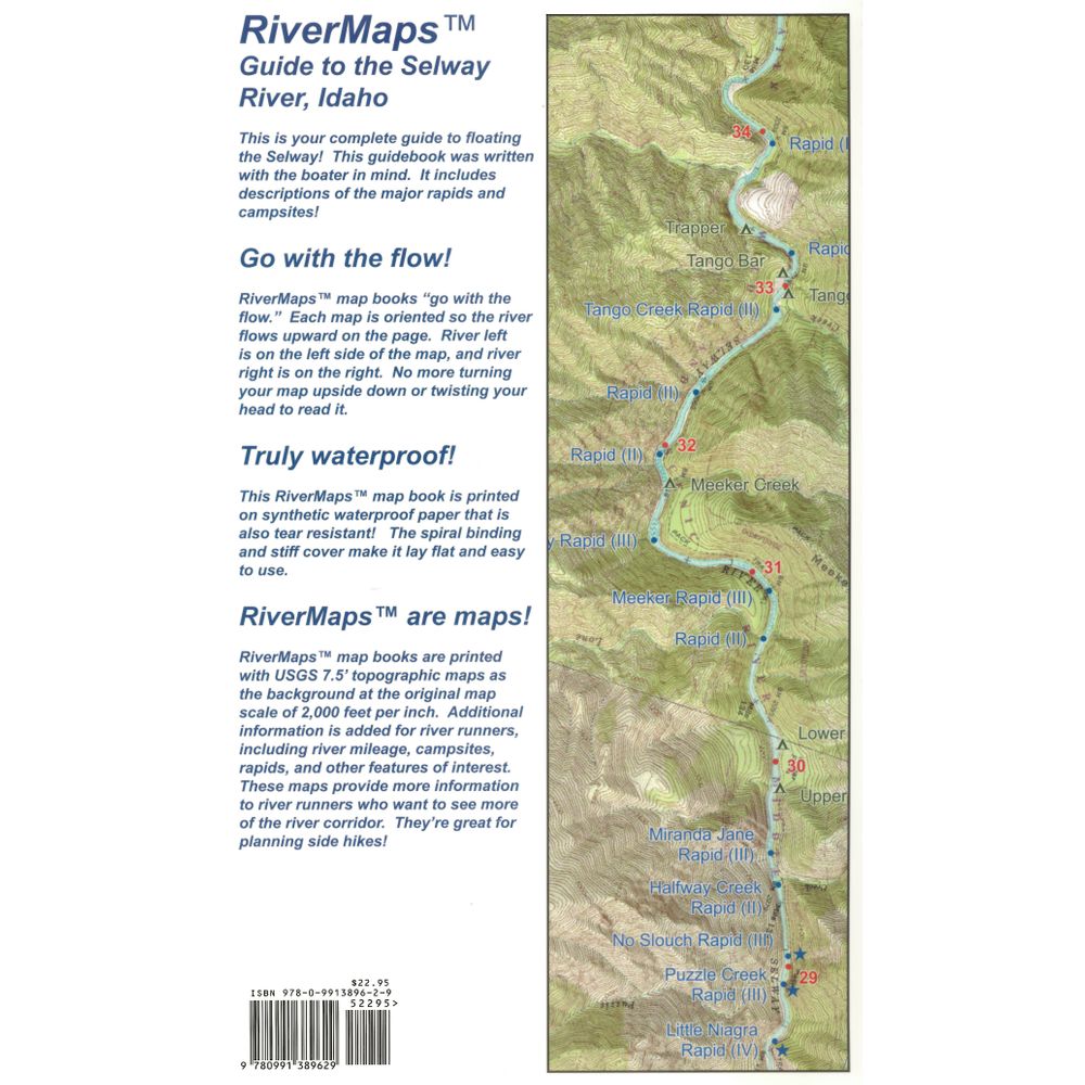
- This guidebook covers the Selway River from the launch point at Paradise Guard Station to the take-out above Selway Falls.
- Spiral bound format with full color topo maps on the right side and complete text descriptions on the facing page.
- Excellent mile by mile information on rapids, campgrounds, geological features, historical sites and reference points.
- The topo maps are on the same scale as the original USGS maps. The contour lines and accurate shape of the river really help you keep track of where you are.
- The maps in this 2nd Edition have been upgraded to show topographic relief shading and more legible text.
- The high quality waterproof paper will stand up to the soaking it’s going to get!
- The book lists side hikes and interesting features away from the river.
- Also addresses frequently asked questions about boating the river, area geology, archeology, resource protection and plants found in the area.
Specs
Subject Matter:
- Guidebooks
Subject Location:
West
Author:
Duwain Whitis & Barbara Vinson
Copyright:
2015 2nd Edition
Size:
9" x 14"
Pages:
28
Water Resistant:
Yes
Features:
- Spiral-bound
- Waterproof, Tear-proof pages
- Map Scale: 1:24,000
You May Also Like

Reviews
Due to your cookie choices, we cannot show you this content. Adjust your settings?
Questions
Due to your cookie choices, we cannot show you this content. Adjust your settings?
 NRS Gift Card: Always Fits, Always Wanted


