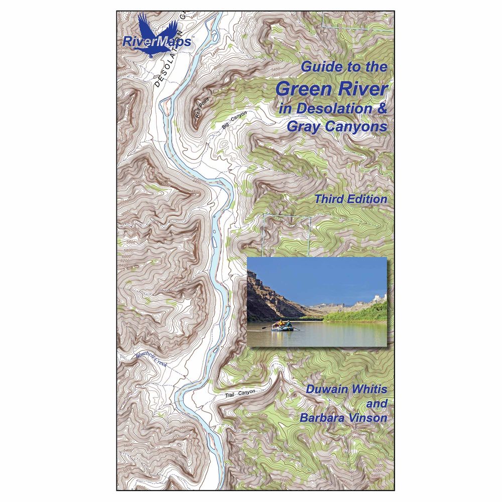
RiverMaps Desolation & Gray Canyon Guidebook 3rd Edition
Shop All RiverMapsProduct Gallery
Price: $31.95
The RiverMaps™ Desolation & Gray Canyon Guidebook provides clear navigation through Utah’s Desolation and Gray Canyons, with details on rapids, campsites, and points of interest. Waterproof pages are durable and easy to read.
Product Details
- Extends the original 84 mile trip—from the Sand Wash put-in to the Swaseys Ramp takeout—to 96 miles now that Tusher Dam allows boats to pass to take out at the Green River State Park Boat Ramp.
- Spiral-bound construction lets the pages lie flat and high quality waterproof, tear-resistant paper handles the splash and abuse of negotiating rivers.
- Full-color topo maps on the right side and complete mile-by-mile text descriptions of major rapids, campsites, and features of interest on the facing page.
- USGS topographic maps at the scale of 2,000 feet to the inch (1:24,000).
- The topo maps are the same scale as the original USGS maps. The contour lines and accurate shape of the river really help you keep track of where you are.
- Intro pages offer BLM contact info and regulations, tribal contact and permit info, weather, geology, archaeology, history, ecology, and resource protection wisdom.
Specs
Subject Matter:
- Guidebooks
Subject Location:
West
Author:
Duwain Whitis & Barbara Vinson
Copyright:
2026
Size:
9" x 14"
Pages:
43
Water Resistant:
Yes
Features:
- Waterproof paper
- Map Pages: USGS color topo reproductions
- Scale: 2,000 feet per inch (1:24,000)
You May Also Like
Reviews
Due to your cookie choices, we cannot show you this content. Adjust your settings?
Questions
Due to your cookie choices, we cannot show you this content. Adjust your settings?
 NRS Gift Card: Always Fits, Always Wanted


