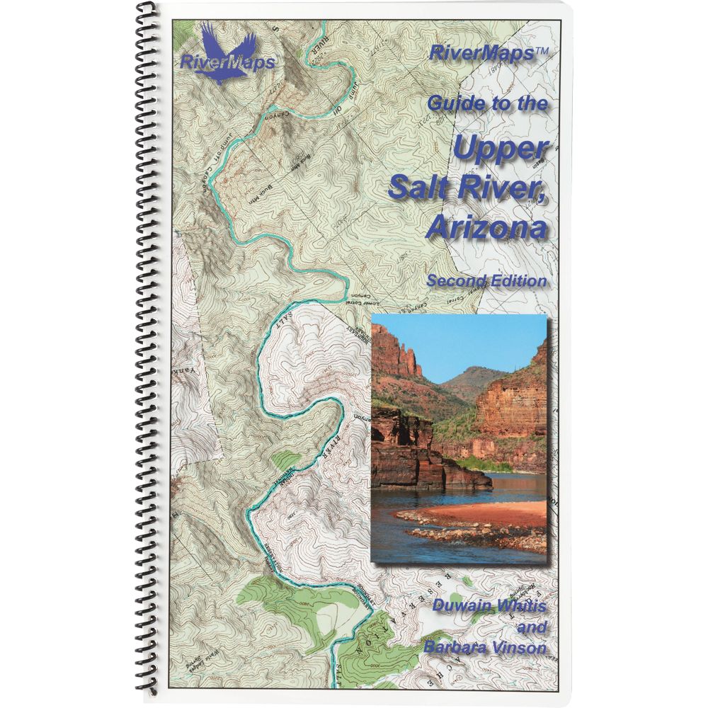
RiverMaps Salt River Arizona 2nd Edition Guide Book
Shop All RiverMapsProduct Gallery
Product Gallery Thumbnails


Price: $27.95
Two-and-a-half hours from central Phoenix, the Salt River flows through the Sonoran desert with 52 miles of raftable water. Featuring waterproof USGS maps and detailed descriptions of 33 named rapids, plus camps, the 2023 RiverMaps Salt River Arizona Guide Book is an essential companion.
Product Details
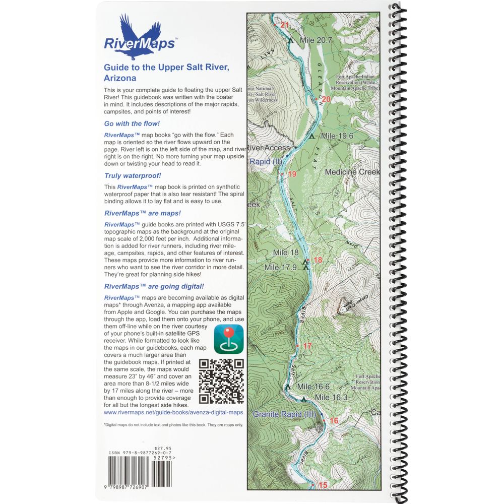
- This book covers the entire permitted portions from the put-in at Highway 60 through the South Gleason River Access to the take-out at Highway 288 on the Upper Salt River.
- Mile-by-mile information on rapids, campgrounds, geological features, historical sites and reference points.
- The topo maps are the same scale as the original USGS maps. The contour lines and accurate shape of the river really help you keep track of where you are.
- Includes information regarding Tonto National Forest river trip regulations, White Mountain Apache Tribal Lands Recreational permits, and the geological and archeological history of the area.
- Printed on high-quality waterproof paper to prevent ink from smearing and is tear-resistant to keep your guide intact throughout the trip.
- Spiral bound format with full color topo maps on right side and complete text descriptions on the facing page.
- With book in hand, maps read from bottom to top to match the downstream flow of the river.
Specs
Subject Matter:
- Guidebooks
Subject Location:
Southwest
Author:
Duwain Whitis & Barbara Vinson
Copyright:
2023
Size:
9" x 14"
Pages:
28
Water Resistant:
Yes
Features:
- Waterproof
- USGS 7.5" color topo map reproductions
- Scale: 2,000 feet per inch (1:24,000)
You May Also Like
Reviews
Due to your cookie choices, we cannot show you this content. Adjust your settings?
Questions
Due to your cookie choices, we cannot show you this content. Adjust your settings?
 NRS Gift Card: Always Fits, Always Wanted


