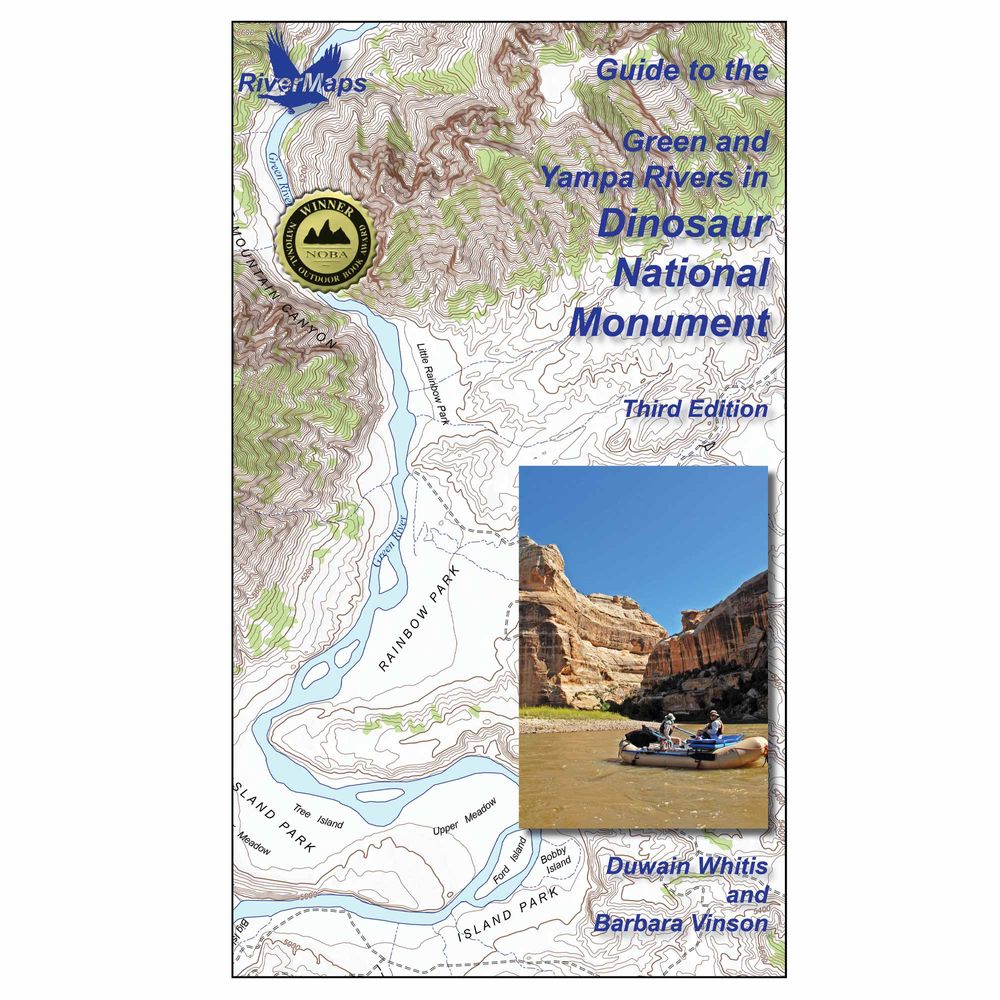
RiverMaps Green & Yampa in Dinosaur Guidebook 3rd Edition
Shop All RiverMapsProduct Gallery
Price: $31.95
Plan your trip through Dinosaur National Monument with the RiverMaps™ Green & Yampa Rivers Guidebook. Includes USGS maps, plus clear descriptions of rapids and camps. Durable waterproof pages handle the wear and tear of life on the river.
Product Details
- Covers both the 43 miles of the Gates of Lodore to Split Mountain section of the Green River and the 46 miles on the Yampa River’s Deerlodge Park put-in to its confluence with the Green. Boaters on the Yampa float their final 25 miles on the Green River to the Split Mountain take-out.
- These large format books are printed on tough waterproof paper and spiral bound so they lay flat and can take the waves, splash and wear of a river trip.
- Opened up, the left side page has mile-by-mile descriptions of major rapids, campsites, and features of interest. There are also great color photos that illustrate the text.
- The right side page features color USGS topographic maps at the scale of 2,000 feet to the inch (1:24,000). There’s no better way to keep track of where you are on the river.
- The front of the book contains detailed information about the rivers, landscape, flora and fauna, and more.
- Front eight pages include Park Service contact info as well as regulations, weather, geology, archaeology, history, ecology, and resource protection wisdom.
Specs
Subject Matter:
- Guidebooks
Subject Location:
West
Author:
Duwain Whitis & Barbara Vinson
Copyright:
2026
Size:
9" x 14"
Pages:
38
Water Resistant:
Yes
Features:
- Waterproof paper
- Map Pages: USGS color topo reproductions
- Scale: 2,000 feet per inch (1:24,000)
You May Also Like
Reviews
Due to your cookie choices, we cannot show you this content. Adjust your settings?
Questions
Due to your cookie choices, we cannot show you this content. Adjust your settings?
 NRS Gift Card: Always Fits, Always Wanted


