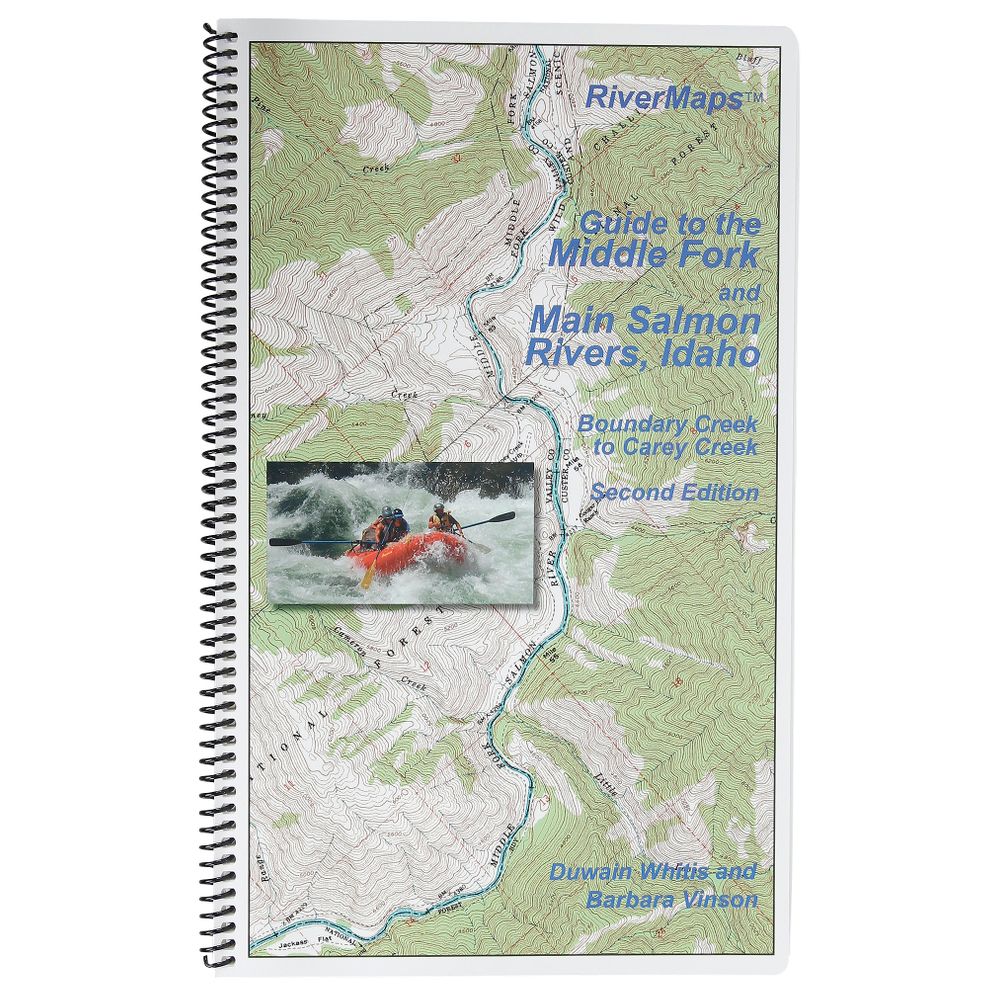
RiverMaps Middle Fork & Main Salmon River 2nd Edition Guide Book
Product Gallery
Product Gallery Thumbnails


This product is no longer available, but we’ve got more options for you:
The Guide to the Middle Fork and Main Salmon Rivers is a must-have guidebook for your trip down the Salmon. Durable and waterproof, with USGS maps and excellent descriptions of river features.
Product Details
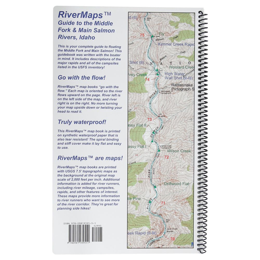
- This book covers the entire Salmon river, from the Boundary Creek launch site on the Middle Fork to the Carey Creek take out on the Main Salmon.
- Spiral bound format with full color topo maps on right side and complete text descriptions on the facing page.
- Color photo's highlight some of the rivers more famous attractions and features.
- Excellent mile by mile information on rapids, campgrounds, geological features, historical sites and reference points.
- The topo maps are the same scale as the original USGS maps. The contour lines and accurate shape of the river really help you keep track of where you are.
- The high quality waterproof paper really stands up to the soaking it's going to get!
- The book lists numerous side hikes and interesting features away from the river.
- There are also info pages on frequently asked questions about boating the river, area geology, archeology, resources protection and plants found along the river.
Copyright: 2011 2nd Edition
Size: 9"w x 14"h waterproof paper
Pages: 71
Map Pages: USGS 7.5" color topo reproductions
Scale: 2,000 feet per inch (1:24,000)
Specs
Subject Matter:
Guidebooks
Author:
Duwain Whitis & Barbara Vinson
Copyright:
2011
Size:
9" x 14"
Pages:
71
Features:
- Waterproof
You May Also Like
Reviews
Due to your cookie choices, we cannot show you this content. Adjust your settings?
Questions
Due to your cookie choices, we cannot show you this content. Adjust your settings?
 NRS Gift Card: Always Fits, Always Wanted


