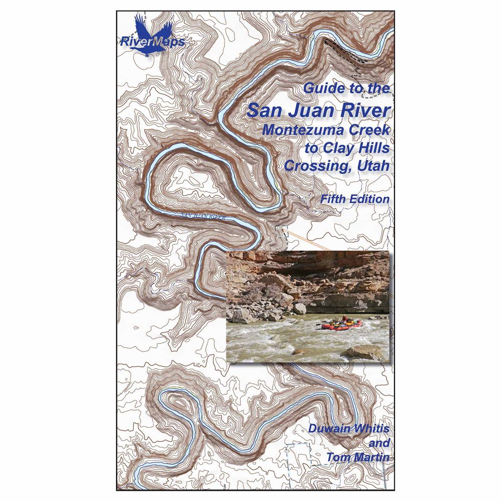
Created by experienced river runners, the fifth edition of the RiverMaps™ San Juan River Guidebook delivers detailed, mile-by-mile beta along with camps, side hikes, and more. Spiral-bound and waterproof make it easy to use right on the water.
Product Details
- This guide covers 84 miles of the San Juan River from Montezuma Creek to Clay Hills Crossing including color photos with up-to-date data on camps and river features.
- Mile by mile information on rapids, campgrounds, geological features, historical sites, and reference points.
- With book in hand, maps read from bottom to top to match the downstream flow of the river.
- The topo maps are the same scale as the original USGS maps. The contour lines and accurate river shape enhance your ability to keep track of where you are.
- Relief shading of the topo map offers a much clearer perspective of the terrain.
- Printed on high-quality waterproof paper to prevent ink from smearing and is tear-resistant to keep your guide intact throughout the trip.
- Spiral-bound format with full color topo maps on the right side and complete text descriptions on the facing page.
Specs
Subject Matter:
- Guidebooks
Subject Location:
Southwest
Author:
Duwain Whitis & Tom Martin
Copyright:
2026
Size:
9" x 14"
Pages:
38
Water Resistant:
Yes
Features:
- Waterproof paper
- Map Pages: USGS color topo reproductions
- Scale: 2,000 feet per inch (1:24,000)
You May Also Like
Reviews
Due to your cookie choices, we cannot show you this content. Adjust your settings?
Questions
Due to your cookie choices, we cannot show you this content. Adjust your settings?
 NRS Gift Card: Always Fits, Always Wanted


