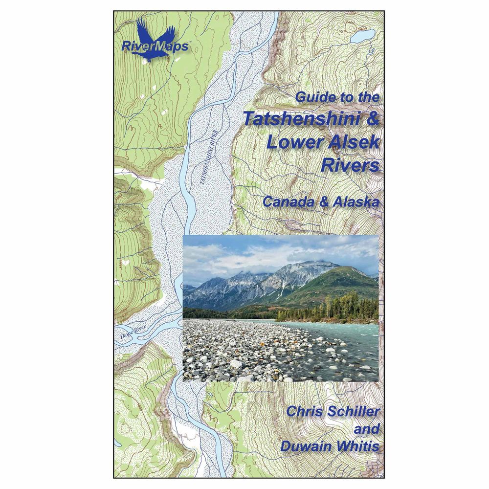
RiverMaps Tatshenshini & Lower Alsek Guidebook 1st Edition
Shop All RiverMapsProduct Gallery
Price: $33.95
The RiverMaps™ Tatshenshini & Lower Alsek Guidebook is an essential resource for planning and navigating these large, remote rivers. Detailed maps provide mile-by-mile beta, camp information, safety tips, and more. Durable, spiral-bound pages are waterproof for reliable use on the river.
Product Details
- This book covers 127 miles from the Shäwshe (Dalton Post) access point off the Haines Highway in Yukon to the take-out at Dry Bay, Alaska.
- Contains information on permits, regulations, outfitter info including places to rent gear, bear safety, gear recommendations, and air taxis which are required for taking out at Dry Bay.
- Due to the highly braided nature of these rivers, the maps depict a primary channel with flow lines representing braiding.
- Mile by mile information on rapids, campsites, geological features, and reference points.
- With book in hand, maps read from bottom to top to match the downstream flow of the river.
- Maps 1–14 are printed at a scale of 2,000 feet per inch, and maps 15–19 are printed at a scale of 4,000 feet per inch due to the enormous width of the Alsek.
- Printed on high-quality waterproof paper to prevent ink from smearing and is tear-resistant to keep your guide intact throughout the trip.
- Spiral-bound format with full color topo maps.
Specs
Subject Matter:
- Guidebooks
Subject Location:
West
Author:
Chris Schiller & Duwain Whitis
Copyright:
2026
Size:
9" x 14"
Pages:
49
Water Resistant:
Yes
Features:
- Waterproof paper
- Color topo reproductions
You May Also Like
Reviews
Due to your cookie choices, we cannot show you this content. Adjust your settings?
Questions
Due to your cookie choices, we cannot show you this content. Adjust your settings?
 NRS Gift Card: Always Fits, Always Wanted


